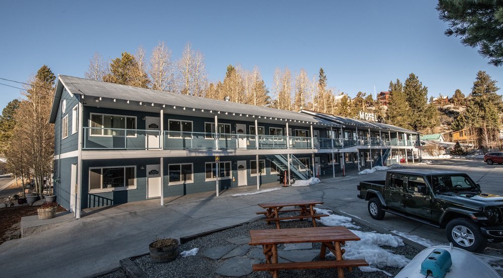
Winter in June Lake
Winter is a magical time in the Eastern Sierras!
Legendary skiing and snowboarding, incredible views, a quieter pace, hot spring access, ahhh…there’s something for everyone.
Conditions can vary quite a bit during winter and shoulder season, so before your visit, read this page for important information on travel, safety, conditions, activities, and other good-to-know details.
When is winter in June Lake?

We generally consider November - March winter in June Lake and the Eastern Sierras, but it’s common for wintery conditions to stretch well into spring and fall (it’s not unheard of to see snow in the summer months).
Higher elevations and mountain passes are impacted the most by early and late-season winter weather, and backcountry and resort skiing extends (and often improves) well into the spring months.
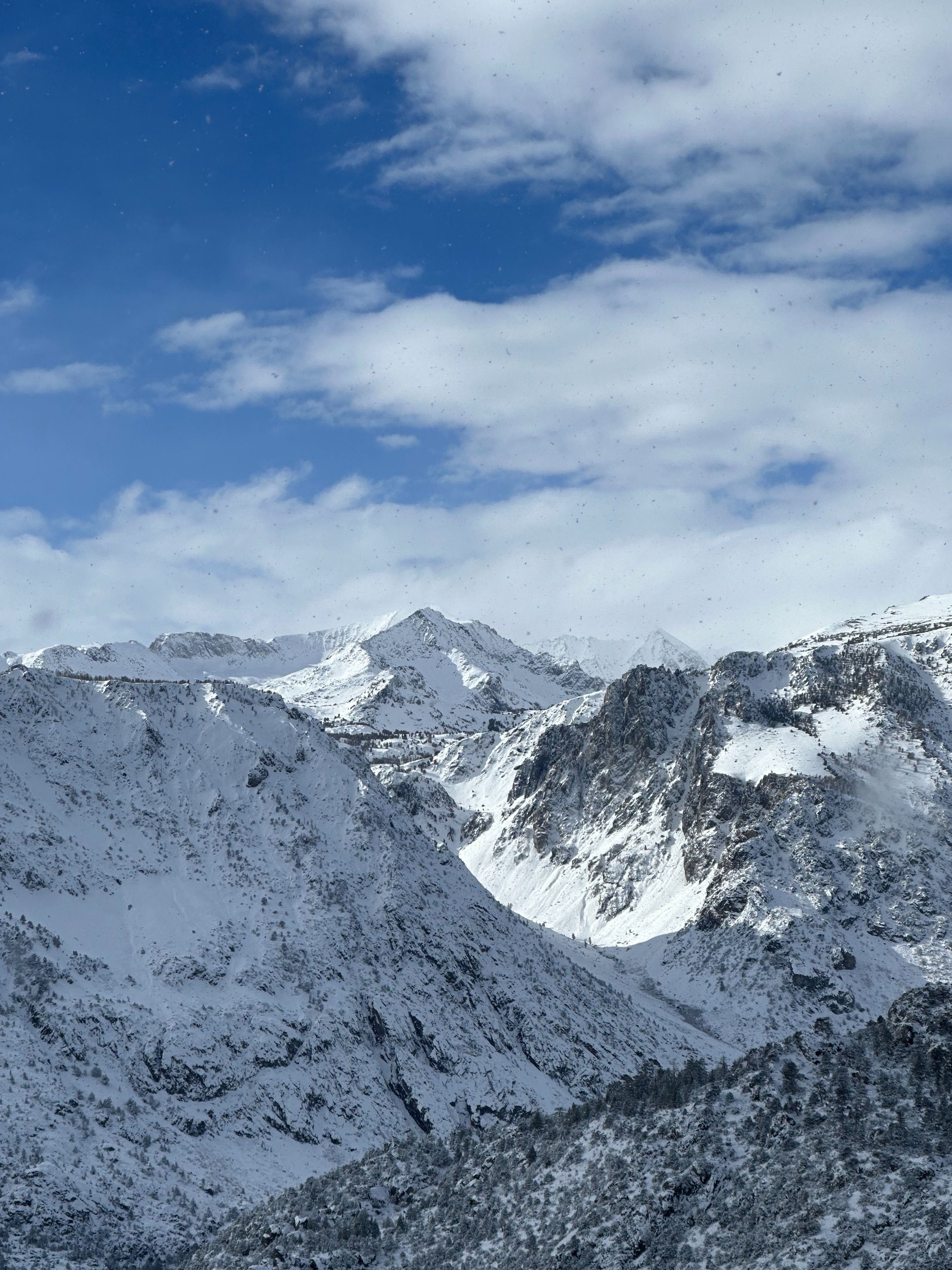
Winter conditions in the Eastern Sierras
Winter weather in June Lake is a marvel in and of itself!
Winter conditions in the Eastern Sierra are typically marked by intense snow storms followed by periods of brilliant bluebird skies and sunshine. When they come, winter storms regularly drop over a foot of snow, often with several feet of accumulation.
June Lake is nestled at 7,600 feet above sea level, so while conditions vary year-by-year, high winds, intense sun, rapidly changing conditions, and “feast or famine” snowstorms are all to be expected.
Always prepare yourself, your travel group, and your vehicle for winter conditions.
Build in flexibility to your travel plans in case you need to travel early or take off a day later than expected.
If winter travel doesn’t sound like your thing, we recommend planning your trip more last-minute when there’s not a storm in the forecast.

Seasonal road closures in the Eastern Sierras
Seasonal road closures in the Eastern Sierras can be confusing–there’s a lot of information out there, and conditions can change quickly when winter weather rolls in. CalTrans is a well-oiled machine though, and they do a great job keeping travelers safe and informed. Their CalTrans QuickMap is our favorite resource for quick, easy information on road closures.
Two types of road closures impact travel to and from the Eastern Sierras during winter and shoulder season:
Roads that routinely close over the winter/shoulder season, and
Roads that remain open, but may temporarily close during severe weather.
Roads that routinely close over the winter/shoulder season:
The timing of the closures varies from year to year, but generally, these seasonal closures begin whenever the first severe weather rolls in. Prepare alternative driving routes for winter, fall, and spring visits, and always check CalTrans before you leave.
Occasionally, when severe weather hits abnormally early, CalTrans may temporarily close these roads and then reopen them. CalTrans crews typically start clearing snow in April, which can take several weeks to months.
These road closures mainly impact travel to and from June Lake:
Tioga Pass (SR120) and Yosemite’s eastern entrance close during winter/shoulder season, typically from early to mid-November through late May or June, though it varies. During this time, the primary access to June Lake from the western Sierras is through the I-80 pass around Lake Tahoe or south of the Sierras near Los Angeles. Beyond winter and shoulder season, Tioga may close intermittently due to severe weather.
The Northern Section of the June Lake Loop (SR158) closes during winter (between its northern entrance off 395 and Rush Creek near Powerhouse Rd). Visitors can reach the town using the southern entrance at the June Lake Junction.
Ebbetts Pass (SR4) closes during the winter and into the shoulder seasons.
Monitor Pass (SR89) closes during the winter between the SR4 (Ebbetts) junction and US 395. Weather is usually milder along Monitor Pass, so the road may stay open (or partially open) during mild winters.
Sonora Pass (SR108) closes during the winter and into the shoulder seasons.
Minaret Summit (SR203) closes west of Mammoth Mountain’s Main Lodge. Winter access is also closed along Reds Meadow Road and Devils Postpile Road.
*See full closures on CalTrans. Other roads may closed temporarily around winter storms.
The best source for information on Sierra road conditions is the Caltrans QuickMap. For roads in Nevada, visit the Nevada Department of Transportation site.
Safety tips: Winter driving in the Eastern Sierras
Make sure your winter travels to and from the Eastern Sierras go safely and smoothly by reading through these winter travel and safety tips before your visit. Share them with your group too! More information on Winter Driving Tips from CalTrans here.
Be prepared for winter conditions: If you’re uncomfortable with winter driving, we recommend planning your trip last-minute when the forecast is free of winter storms.
Check conditions regularly: Check weather and road alerts before you embark, while you’re on the road, and again before you head home. See our “Resources” section for links.
Prepare your vehicle and pack emergency supplies: CalTrans has a great winter vehicle preparation and packing list here. Winterize your vehicle by checking brakes, tire pressure, battery levels, windshield wipers, defroster fluids, heaters, headlights, and exhaust systems. Pack chains, and plan to keep your gas tank full along the way. Pack some emergency supplies in your car, including flashlights, extra clothing, snacks and water, towels, gloves, scrapers, shovel, a spare key, and material to help with traction (like kitty litter or MaxTrax).
Pack tire chains (and know how to use them):
All vehicles (even cars with AWD or snow tires) must carry chains during snowy conditions. If you don’t pack them when required, CalTrans may ticket you or turn you back.
You can purchase tire chains online or at automotive shops, gas stations, general stores, Walmarts, etc.
If CalTrans requires chains, you’ll see highway signs indicating it, followed by a pull-off area where you can put them on. Before installing chains on the highway, ensure you’re safely pulled off the highway and visible to other vehicles. The speed limit when chains are required ranges from 25-35 MPH (they’ll be posted).
Chain assistants: During storms, chain assistants are typically set up on Highway 203 (before Mammoth) and Toms Place. Permitted installers wear a vest with their vendor number on it.
Expect travel delays, be patient, and pad in extra travel flexibility: Winter travel to the Eastern Sierras can take longer due to storm conditions, icy roads, and road closures. Plan to leave early to allow enough time to reach your destination, and know that storms may force you to leave earlier or later than expected. Add travelers’ insurance to your bookings, review hotel cancellation policies, and cancel within the cancellation period if a winter trip doesn’t sound right for you.
Keep your distance from plows: #DontCrowdThePlow and stay at least four car lengths back from working plows.
Trust the process (CalTrans style): Please know that CalTrans is very safety-focused, and their operations come from years of experience. If the roads are open, they’re deemed safe for travel.
Winter safety in town
Watch for “roof avalanches”: Roof avalanches occur when accumulated snow and ice slide from the roof of a man-made structure. Suffocation and/or trauma from roof avalanches is dangerous and can be fatal. They often occur during periods of warmth following snowstorms, so they’re very common in June Lake and the Eastern Sierras. Be VERY cautious, avoid standing or parking beneath rooflines, and watch your kids and pets when they’re playing.
Beware of icy surfaces: Due to occasional rapid snow accumulation in the area, walkways may become slippery. We work to keep our parking lot and walkways plowed and de-iced throughout winter, as does the town of June Lake, but use caution walking and driving on icy surfaces. We recommend bringing Yaktrax for further traction while walking if you're concerned.
Watch out for snow machines: Stay vigilant around plows and snowblowers, and make sure you give them plenty of space to work.
Winter recreation safety
Recreating outdoors during winter and shoulder season requires extra safety precautions, so before you head out to enjoy the outdoors, familiarize yourself with safety practices related to snow, ice, avalanches, freezing temperatures and hypothermia, closures, and more.
If you plan to recreate in snowy conditions or near ice fields, always speak with a pro about safety practices and trails, bring the appropriate layers, travel with a buddy, check trail conditions and closures, plan out timing based on daylight, understand how the sun will impact conditions, check the weather, understand snow-specific hazards, bring your micro spikes, poles, and avalanche gear if needed, and pack other emergency/survival supplies.
Avalanches commonly occur during the winter and spring. If you plan to recreate in avalanche terrain or connected terrain, take all precautions including taking an avalanche course, carrying avalanche equipment, checking in with the regional avalanche center, and reading up on advisories and observations. The Eastern Sierra Avalanche Center covers the eastern Sierra region from Lee Vining to Bishop.
Packing for your winter trip to the Eastern Sierras
Lots of layers!
Safety and Traction: Snow Shovel, Ice Scraper, Sand or Cat Litter.
Backup Power: Portable Power bank or solar charger.
Snow Tires and Snow Chains.
Extra water and non-perishable food.
Emergency supplies: Read here for CalDOT’s recommendations for equipping your car for winter driving

Winter Activities Around June Lake
-
Resort Skiing:
June Mountain (opening date scheduled for December 21, 2024).
Mammoth Mountain (opening scheduled for November 15, 2024).
Cross-Country Skiing
Snowshoeing
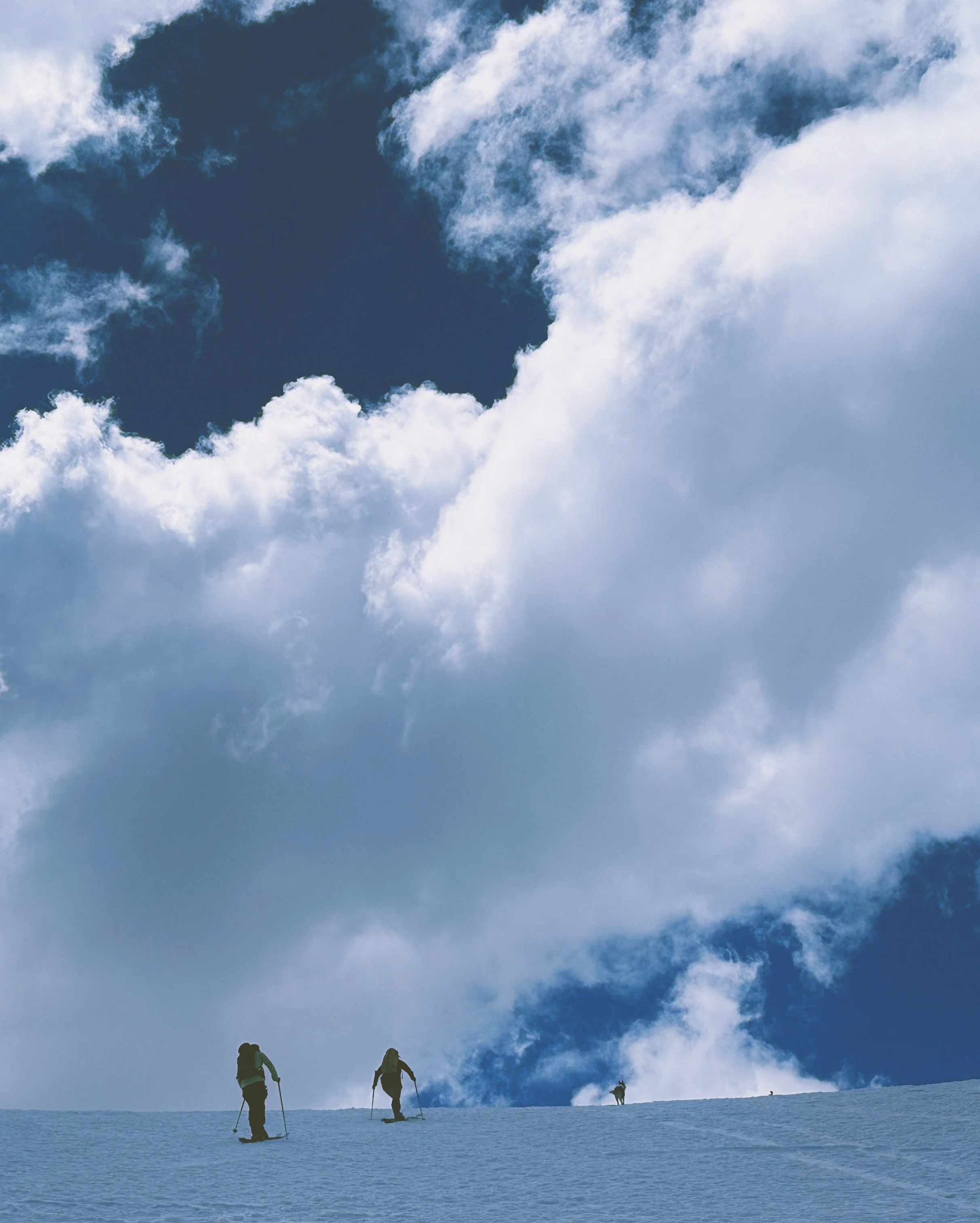
Backcountry Skiing
Plenty of terrain for everyone from beginner to experienced expert backcountry skiers.
It can take a couple of months to make a solid base. Backcountry skiing tends to improve later in the season once the snowpack has developed more fully, after December, but it can vary. There’s a ton of variation in terrain, elevation, and conditions throughout the Eastern Sierra, so snow conditions vary dramatically.
March-April, days get longer and snowpack typically deepens to accommodate longer approaches and fuller descents.
High winds, intense sun,
If you plan to recreate in snowy conditions or near ice fields, know all safety practices before you go:
Bring layers
Travel with a buddy, check trail conditions and closures
Plan out timing based on daylight and know how the sun will impact conditions
Check the weather, understand snow-specific hazards
Bring your micro spikes, poles, and avalanche gear
Pack other emergency/survival supplies.
If you plan to recreate in or near avalanche terrain, take all precautions including carrying avalanche equipment, taking an avalanche course, and speaking with a ranger ahead of time.
For more info, visit Avalanche.org, the Eastern Sierra Avalanche Center, and the Sierra Avalanche Center.
-
Silver Lake has been named one of the Top Ice Fishing Destinations in the US given its gorgeous views, easy access, and fish, so if you're planning on ice fishing during your stay, you really can't go wrong here!
From November 16th to the last Friday in April, winter regulations apply. Mono County allows winter fishing on several streams and rivers (no lakes or reservoirs other than Topaz Lake), and is catch-and-release only using barbless, artificial lures and flies.
Winter Fishing Spots
Topaz Lake. West Walker River, Little Walker River, Buckeye Creek, Virgina Creek, Green Creek, Robinson Creep (excluding sections from US Forest Service Boundary to Upper Twin Lake, between Lower and Upper Twin Lakes).
Lee Vining Creek (upstream from the Lee Vining conduit), Hot Creek, McGee Creek, Upper Owens River, and Rock Creek. Please check road conditions, for example, Hot Creek is unplowed and may require 1-2 miles of walking.
Saddlebag, Ellery, and Tioga Lakes are listed as year-round fishing, but due to road closures, they are not accessible in the winter months.
Always bring layered clothing, waterproof footwear, clothes, and water, and check conditions before heading out.
Fishing and Hunting Regulations (ca.gov) (winter regulations for each lake, river, and stream can be found here).
-
Golden State Guiding June Lake Ice Climbing: Full or Half Day.
Sierra Mountain Center: Intro to Ice Climbing, 2 days.
International Alpine Guides- Ice Climbing Classes: 2 days, begins in Lee Vining, ends in June Lake.
-
Winter Fat Biking is allowed on groomed motorized OSV trails, and non-motorized winter trails at Obsidian Dome and Shady Rest.
Only Purpose-built fat bikes with 3.8' wide tires or wider, with a recommended tire pressure of 6-10 PSI are allowed on trails.
If you leave a rut deeper than 2 issues or are unable to ride in a straight line, it's too soft to ride. Firm snow is the best snow for Fat Biking.
Please check conditions and be weary of ice patches before hitting the trails!
Mammoth Lakes Trail System | Winter Fat Biking (mammothtrails.org)
-
Guided Tours
Self-Guided Tours (Need Own Sled)
Inyo National Forest Trails: There are miles of roads and play areas in Mammoth Lakes, June Lake, and Mono Lake areas. The Inyo National Forest's Winter Recreation Map has a huge map of trails, as well as conditions and guides for equipment.
Be sure to check the Current Grooming Reports and Eastern Sierra Avalanche Center for advisories and conditions before heading out.
A 7,254-acre section of the Humboldt-Toiyabe National Forest, located to the east side of Sonora Pass\SR 108 are Caltran's (People's Gate), about six miles west of US 395 between Bridgeport and Walker. Permits are free, but mandatory, and can be obtained online from the Bridgeport Avalance Center, Bridgeport Ranger Station, or at People's Gate Entrance at Bridgeport Winter Recreation Area. Call Bridgeport Ranger Station at (760) 932-7070 for more information. Before venturing, please be sure to have the property safety equipment and an understanding of hazards, snow, and avalanche conditions. You can view current conditions and advisories at https://bridgeportavalanchecenter.org/.
-
Woolly's Tubing Park: Opening day depends on the weather, but typically, they are open from late November to early April. Located near Mammoth Mountain, Woolly's Tubing Park is a great place for kids and adults alike! This formal sledding hill has a conveyor belt to transport sledders to the top of a hill to sled down groomed lanes, there is no need to worry about trekking uphill for each run! They also have a snow play area (great for making snowmen and having a classic snowball fight), warmed decks, and hot drinks and snacks.
A favorite free June Lake sledding spot can be found 6 miles south of June Lake on Highway 395 near Glass Creek Campground. Off to the right of the highway is a large parking area right at the trailhead of popular cross-country skiing trails.
-
LA Kings Ice is an Olmypic-Size Indoor Ice Skating Rink at the Community Rec Center in Mammoth Lakes. Public skate is open daily from mid-October through April.
Bridgeport Ice Skating Rink is free of charge and is located at the intersection of US 395 and Highway 182.
-
This is hot spring country! Not only are we lucky to have one of the most concentrated (and beautiful) crops of hot springs in California, but they’re also almost all-natural (with alterations just to make them bather-ready). Speaking of all-natural, many of these springs are au naturel too–just a heads up!
When to go:
The springs along 395 have gained quite a bit of popularity in the last few years, so shoulder season and weekdays are your best bet to beat the crowds.
Overview:
Near Bridgeport
Travertine: Pools ranging from 90-110°F just south of Bridgeport (worth the drive for fewer crowds). Named after the colorful travertines (calcareous rock deposits) around the pools. Pools are year-round, but the road may be impassible during wet and snowy weather. No camping, but you can check out nearby forest service campgrounds.
Buckeye: Off-the-beaten-path (and fewer crowds for that reason), Buckeye is about 10 miles southwest of Bridgeport. Two soaking pools at around 100°F. Most accessible during spring, summer, and fall (high clearance 4x4 vehicle recommended). During winter, you can ski in. You may camp in the forest service campground about a mile away.
Long Valley Primitive Springs (near Benton Crossing). These tend to be more well-known and highly trafficked.
Wild Willy’s (Crowley Hot Spring): A popular spot featuring a large rock/cement pool (about 95°F) and a smaller pool (about 105°F). Camping is prohibited at the spring, but available at nearby public land spots. The 1.2-mile dirt road is accessible during summer, fall, and parts of spring, but note that it’s impassible during winter and wet weather. Note that you’ll have to make the final 100 yards to Crowley by foot (and further during winter).
Hilltop Hot Spring (Pulkey’s Pool): A newer tub atop a hillside with fantastic views of the Sierras. Accessible year-round (with a bit more walking necessary during wintery or wet weather). Camping is not permitted.
Crab Cooker
The Hot Tub: Large bathtub-style pool that stays around 100°F. Camping is allowed here. During summer and fall, the road is well-maintained for easy access. It may be impassible during wet or winery weather. Camping is available at the spring or neighboring forest service spots.
Shepherd Hot Spring: A single-tub pool that stays around 100°F. Make sure you’re off-road ready for this one; the road is rougher than those to other springs in the area, and it may be impassible in wet or wintery weather. Don’t camp at Shepherd Hot Spring itself, but there are camping spots on the public land a few hundred yards to the west.
Alkali Lake Hot Spring: By far the least developed spring in the Long Valley area, Alkali Lake Hot Spring is pretty small, shallow, and undeveloped…and it requires diverting water before it’s safe to use. The water stays around 115°F, so make sure you alter the temperature by diverting water out and letting it cool. Camping is not permitted.
Little Hot Creek: This one’s a bit further from the others in Long Valley. Be extremely careful at this one–the temperature flowing from the spring is 180°F and cools to 115°F by the time it reaches the tub, so you’ll need to divert water out and let it cool off before enjoying. Camping not permitted. Accessible with high-clearance vehicles during summer, fall, and parts of spring (note the road may be impassible during wintery or wet weather).
Siphon: Bigger 10-person tub
South into Owens Valley
Keough Hot Ditch, Owens Valley Warm Spring, and Dirty Sock Hot Spring
Out there: Saline Valley Hot Springs
Meh options
Mono Basin Warm Springs: On the isolated eastern side of Mono Lake, 85°F. Do it at your own risk with an off-road vehicle equipped for deep sand. Stay away during wet weather. No camping.
Precautions
Water temperature: Read all posted signs about heat safety and water temperature, and ALWAYS test the water with a finger before getting in. If you can’t see the bottom of the spring, don’t get in–deep geothermal water can vary in temperature dramatically. If it’s too hot, divert water from the spring and let it cool a bit (just make sure to put it back before you leave).
Keep ya head up: Just to be safe, don’t put your head underwater or let water into your nose/mouth (out of an abundance of caution for the amoeba called Naegleria fowleri that can live in geothermal areas).
Are you ready to walk? Many of these springs require some walking, so make sure you have good shoes and enough dry clothing to stay warm.
Is your vehicle ready? Hot springs are often on rugged roads, so make sure your car’s in good shape, carry spare supplies, and have a plan in case of a breakdown.
Are YOU ready? Make sure you know where you’re going and have the right supplies. Cell service is limited or unavailable in these areas.
Tips
For fewer crowds, visit off-season, shoulder-season, and weekdays.
The California Bureau of Land Management can answer your questions about current road conditions, access, permits, weather, camping, and more.
Etiquette
Follow all postings about rules, guidelines, and camping.
Leave No Trace: Make sure you pack out everything you brought in, leave the area as good or better than you found it, and never vandalize or mark up the area. Opt for aluminum over glass containers to avoid leaving dangerous broken glass behind. And please, no peeing in the pools!
Clothing is often optional: Many spring goers opt to go au naturel, so heads up before you visit. Follow all posted signs regarding clothing.
Water temperature: Temporarily diverting water from the hot spring allows you to cool the pool water; if you divert the hot spring water, just make sure you leave it as you found it so the pool’s warm for the next visitor.
Be kind and respectful: Read the room, check the vibe, give folks space, and be kind and courteous to your fellow spring goers. Have fun!
Winter events around June Lake
Bucky's Bonfire: a weekly event that takes place at June Mountain Ski Area every Saturday at 1:30 PM between December 14, 2024-April 12, 2025. Includes Silent DJ for children, live DJ for adults, games, bonfire, and photo oppurtunities with Bucky. https://www.junemountain.com/things-to-do/buckys-bonfire
June Mountain Opening Day: December 21, 2024, between 7:30 am-4:00 PM.
Mammoth Mountain Opening Day: November 15th 8:30 AM-4:00 PM. Annual first chair and banner breakthrough, followed by a toast to the new 71st season.
Unbound Series at Mammoth Mountain from March 7 at 8:30 am- March 9 at 4:30 PM. USASA member event for all ages and skill levels. Winners will qualify for a chance to participate in the USASA National Championships, each event will feature a medal ceremony and a chance to win items!